 After our trip up the eastern side of the island as far as
Orchid Beach we had returned to Eurong with an hour to spare before high
tide. It was raining consistently but
after a short coffee break we decided that we would go and wander down to the
beach to see how high up the beach the tide came. Although there was still plenty of sand right
at the entrance looking back up the beach the waves were breaking near the sand
cliffs.
After our trip up the eastern side of the island as far as
Orchid Beach we had returned to Eurong with an hour to spare before high
tide. It was raining consistently but
after a short coffee break we decided that we would go and wander down to the
beach to see how high up the beach the tide came. Although there was still plenty of sand right
at the entrance looking back up the beach the waves were breaking near the sand
cliffs.
We stayed on the middle floor of the accommodation block
overlooking the pool – doesn’t look too attractive on a wet day but I am sure
very pleasant during the much warmer summer days.


Next morning was our last day on the island but as we were
on the 5 pm barge we had plenty of time to continue exploring. We decided initially that we would return up
the east side of the island as we had missed stopping off at Eli Creek the
previous day due to the incoming tide.
So after buffet breakfast in the dining room we packed up the car with
all our gear so that we could check out, and headed back on to the beach. Eli Creek is about half way up the east side
so about forty kilometres. Eli Creek is the largest creek on the eastern
side of the island and pours up to four million litres of clear, fresh water
into the ocean every hour. It is a
popular stop off for tourists with a boardwalk following the creek inland to an
area where there is a jumping off point for swimming and floating down the
creek. The water was crystal clear but
rather cold, and raining, so I wasn’t going swimming but Peter was happy to
wade in the water. It had been raining
when we first arrived at the creek and we had taken umbrellas along for the
walk but it soon eased to a light drizzle.


The plants along the creek were beautiful and lush and the
lichen on the bark brightly coloured.
Buffet breakfast or not, we had stopped the car so it was snack time for
Peter!


We had been further up the island the previous day so we did
a U-turn and headed back down the eastern side this time heading for Dilli
Village which is about thirty kilometres along the coastline towards Inskip Point
at the southern end of the island where a barge goes to Rainbow Beach which is
near Tin Can Bay. As we travelled back
down towards Eurong the tourist planes were arriving and there were plenty of
hopeful fishermen. The fishermen often
camp at the beachside camping areas (which have no facilities whatsoever) just
following the tracks up the sand dunes to their chosen spot. If not camping, it was common to see the 4wd
parked either on the beach or pulled much further up from the tide level.


Still further down the beach nearer Eurong we were lucky
enough to see another dingo on the beach.


We pulled off the beach at the signpost to Dilli Village –
we were unsure what was actually in the area but had seen that there was a road
into leading to Central Station and the western coast and as we eventually had
to get to that side of the island to catch the barge had decided it was a
worthwhile place to check out. Dilli
Village itself looked quite deserted and we now know that it is a research and
learning centre which is part of the University of the Sunshine Coast. There are also cabins and a grassed area for
camping which appears to be used by various tour companies. There was no one about as we passed. We continued on the track past the village
heading to Lake Boomanjin and Lake Birrabeen.
Our plans soon had to change as there were track closure signs – we were
able to reach Lake Boomanjin but no further.
Our plans to cross the island via these tracks wasn’t going to happen
and as there is no other tracks in this part of the island we would have to do
the run back up the east coast.


Camping is allowed at Lake Boomanjin but interestingly the
camping area was fenced off to protect from the dingoes. There were plenty of signs to warn
visitors. There were toilets but these
were not in the dingo fenced area so I guess night visits would require the
trusty stick. There were no campers
there and we had the place completely to ourselves and didn’t see any dingoes.


After wandering down to the lake edge and having a good look
around we had to return to the beach via the same track we had driven in. Apparently the track further had wash outs
which wasn’t too surprising as there had been a lot of rain. We didn’t pass any other vehicles on our trip
into or out from the lake so we were pleased that we didn’t have any trouble –
obviously these were tracks little used by the general tourist, particularly at
that time of the year.


The tide was still well out so there were no issues from
that prospective. However, there are
lots of tracks down from the sand dunes where the flowing water cuts out channels
on its journey to the ocean. Most of
these were narrow and not too deep but one in particular was quite wide but
there was no option but to drive through.
We stopped off on the beach for our last Fraser Island
picnic – served as usual out the back of the car. Peter took the opportunity to paddle in the
water and then to wade in the water channel we had just come through – not too
deep but deep enough! There were a
number of vehicles making the trek down the beach, obviously heading to Inskip
Point to meet a barge. There were not
wasting any time but then again the speed limit is 80 kilometres per hour on
the beach so they wouldn’t have been breaking any of the rules.
Where we had stopped was near one of the track entrances to
a beach camping area – Govi. These areas
are well sign posted and camping is permitted in the camping zones. This is not free camping and the same fee is
payable as if camping in one of the National Park camping areas (with
facilities) on the island. A permit has
to be displayed showing that the fee has been paid and this can be checked by
the ranger or police. The most annoying
part must be that a pre-booking must be made on line or by ‘phone and there is
nowhere on the island that camping fees can be paid. The beach camps certainly provide an
opportunity for campers to get away and enjoy the tranquillity of the area.


Soon we were back down at Eurong Beach where we would need
to cross the island from east to west – this is the track we had originally
come on. We were getting low on diesel
so fortunately there is fuel available on the island so it was time to invest
in the economy of the island! It
appeared like most retail outlets in this part of the island, the fuel pumps
were part of the Eurong Resort. There
are a lot of young casual employees at Eurong and this young guy said he
couldn’t think of a better place to work and save money – accommodation and
food provided as part of his package, no shops to spend anything at and all the
beach recreation anyone could want. He
had been there ten weeks and just loved it.
It was great to hear a young person so enthusiastic for their work and
his involved working in the general store, and bringing out the key to unlock
the pumps and serving the diesel and petrol.

By now it was after 3 p.m. and we had to meet the barge at Wanggoolba
Creek half an hour before our 5 p.m. sailing.
There was still one place we wanted to explore and that was Central
Station. We followed the inland track
and about half way across the island (about eight kilometres) pulled into
Central Station. This area was
originally an old logging village as logging began on the island in 1963. There are still displays of the various
logging machinery and equipment.
Nowadays the area is the main National Park camping area with large,
fenced formal camping area set in the rainforest.


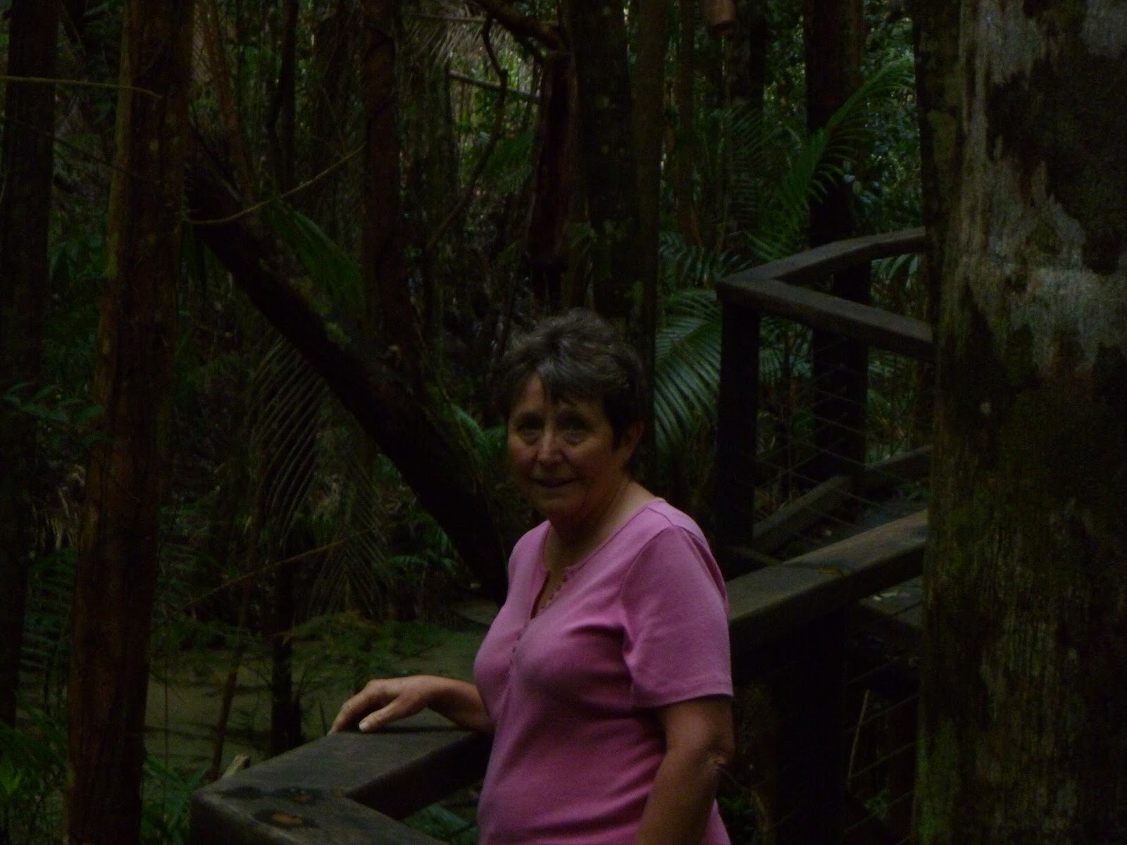
There are lots of walks of various lengths leading off in
all directions. As time wasn’t on our
side (nor did we have the inclination) to do any of the longer walks we chose
to follow the board walk which follows the crystal clear creek down through the
rainforest and then back up through the camping area to the car park. From these photos you may think that the
creek bed was just a sandy bottom with no water, but there was definitely a
stream flowing. It was cool and dark
along the board walk with the tall trees towering above us and dense ferns on
the ground. The lichen on the fallen
trees was very colourful.


It was time to continue our travel along the rainforest
track to Wanggoolba Creek and we still had nine kilometres to go. There were other vehicles on the track so it
was clear there were going to be more than four vehicles on the return
trip. At the barge landing (there isn’t
a jetty but the barge drops a ramp down on to the sand for access) we lined up
with a number of vehicles and watched the barge arriving. In addition to the vehicles and their
passengers there were a lot of foot passengers from the tourist buses.
We had been told that there would be dingoes on Fraser
Island and we hadn’t seen many. We saw
lots of signage warning us, dingo grills and fences and the occasional dingo on
the beach. We were not to be
disappointed as hovering around the car park was a lonely dingo looking for
something to eat. With lots of tourists
on board the barge there were cameras clicking everywhere!


Our barge was late leaving the island, it was waiting for a
booked vehicle that didn’t arrive, and as we sailed the early evening sky was
beautiful. We had enjoyed a great three
days on the island and certainly recommend it to anyone who is happy with accommodation
that is not top class but nature that is.
It was wonderful and we are so pleased we visited. We had visited the main areas of interest on
the island so for us three days was perfect – if you want to go fishing or just
to relax more time would be needed.
Fraser Island is certainly a unique part of Australia.

No comments:
Post a Comment